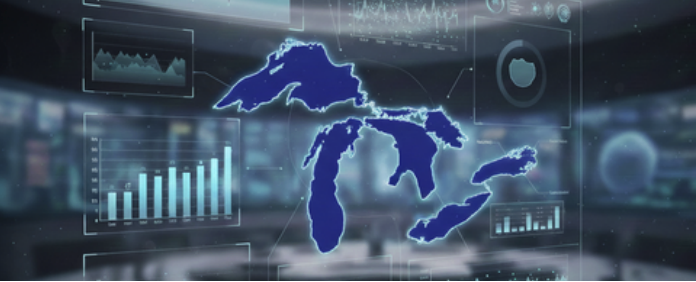
The North American Great Lakes hold about 21 percent of Earth’s surface freshwater and supply drinking water, habitat, transportation and recreation for more than 40 million people in the U.S. and Canada. As climate change, pollution and invasive species stress this system, MIDAS is helping researchers use AI and advanced data analytics to forecast harmful algal blooms, model ice and water levels, and plan for a hotter, more volatile future.
From space, western Lake Erie looks almost beautiful in mid-July, swirled with bands of bright green. Up close, the color tells a different story. The green comes from cyanobacteria, organisms that can produce toxins dangerous to people, pets, and wildlife.
Water plant managers monitor forecasts that blend satellite imagery, buoy data, and computational models to predict how large a bloom will grow and whether it will produce toxins like microcystin. Those forecasts can arrive weeks in advance, time to adjust treatment processes, move intake depths, or issue advisories before contaminated water reaches the tap.
Those bulletins increasingly rely on machine learning and AI, part of a broader effort, supported by the Michigan Institute for Data and AI in Society, to bring data science into every aspect of Great Lakes research and management.
What’s at stake
The Great Lakes hold about 21 percent of Earth’s surface freshwater and support more than 40 million people across the United States and Canada. They provide drinking water, transportation, fisheries, recreation, and habitat, and they are changing rapidly.
Over recent decades, the lakes have experienced record-low winter ice cover, extreme water temperature events, dramatic swings between high and low water levels, and longer growing seasons for harmful algal blooms. During some winters, ice cover during peak season drops to just a few percent, altering lake-effect snow, shipping operations, and aquatic ecosystems.
“The Great Lakes and their coastal ecosystems are changing from a wide range of human impacts,” said Bill Currie, a professor at the School for Environment and Sustainability. “We need tools that help us anticipate those changes and understand how to protect these systems.”
The data challenge
The problem is not a lack of data. Federal agencies such as NOAA, the EPA, and the USGS collect enormous streams of information from satellites, buoys, ships, and shore stations. Universities and state agencies add decades of additional measurements.
A big challenge is integration. Climate data, watershed runoff models, lake temperature and chemistry measurements, and biological monitoring interact in complex ways, but traditional approaches often examine them in isolation.
Machine learning offers ways to handle that complexity by identifying patterns across massive, multi-source datasets and assessing uncertainty across systems. But using these tools well requires close collaboration: environmental scientists need to understand what AI can and cannot do, and data scientists need to understand the physical and biological processes they are modeling.
MIDAS makes connections
MIDAS identified environmental and climate science as areas where data science could have a disproportionate impact and began supporting cross-disciplinary projects through its seed funding programs. These efforts brought together environmental scientists, computer scientists, statisticians, and policy researchers to tackle real-world problems.
One early project focused on forecasting ice conditions in the St. Marys River, the narrow channel connecting Lake Superior and Lake Huron and home to the Soo Locks, critical infrastructure through which roughly 80 million tons of cargo pass each year.
Ice conditions in the river are notoriously difficult to predict, shaped by weather, currents, lake conditions, and lock operations. With support from a MIDAS pilot grant, Ayumi Fujisaki-Manome, a researcher at the School for Environment and Sustainability and the Cooperative Institute for Great Lakes Research, and co investigator Christiane Jablonowski developed machine learning models to forecast ice cover seven to thirty days in advance.
“This isn’t just about convenience,” Fujisaki-Manome said. “It’s about safety. With climate change, we’re seeing much more variability in ice cover, and forecasting that variability helps everyone adapt.”
That work continues through larger projects supported by the National Oceanic and Atmospheric Administration to develop Great Lakes Earth system models that couple ice dynamics with waves, currents, and climate processes.
Preparing researchers and building community
MIDAS also recognized that lasting impact required training. Many environmental scientists have strong quantitative skills but limited exposure to modern machine learning methods, while data scientists often lack deep knowledge of environmental systems.
To bridge that gap, MIDAS launched the Environmental Data Science Summer Academy, a three-day intensive that taught faculty and staff researchers practical skills in machine learning, spatial statistics, time-series analysis, and high-performance computing. “The goal isn’t to turn ecologists into machine learning experts,” said Jing Liu, Executive Director of MIDAS. “It’s to help them collaborate effectively and understand when AI methods are appropriate.”
In 2024, MIDAS and the Cooperative Institute for Great Lakes Research co-hosted an AI Horizons summit focused on the future of AI in Great Lakes science. Researchers from across the country outlined priorities, including better data integration, development of “digital twin” lake models, optimized sensor networks, and expanded AI-based forecasting.
Shifting seasons, shifting risks
Climate change is not only warming the Great Lakes region, it is reshaping the timing of the biological events that unfold across it. MIDAS postdoctoral fellow Yiluan Song and faculty mentor Kai Zhu study these shifts by combining large ecological datasets with machine learning to understand how seasonal cycles are changing and what that means for ecosystems and human health.
Their recent work focuses on fungal spores, an important but underexamined driver of allergy seasons and ecological processes. By analyzing decades of atmospheric, climate, and land-use data, Zhu and Song found that spore seasons now begin more than three weeks earlier than they did in the 1970s, a direct consequence of warming temperatures and changing humidity patterns. The lengthening of these seasons influences respiratory health, forest dynamics, soil processes, and the timing of numerous other species interactions. weather patterns, environmental conditions, and long-term biological records. These tools provide early warnings for shifts in spore activity and other seasonal biological markers, helping public health agencies and environmental managers prepare for climate-driven risks.
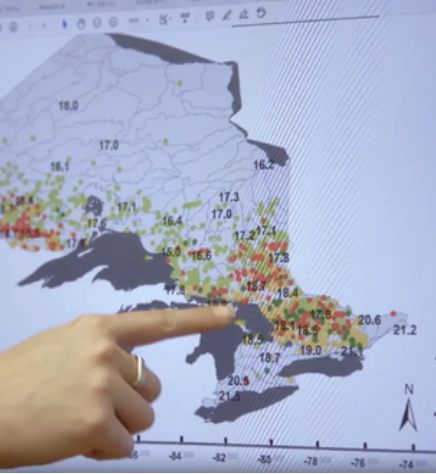
Karen Alofs points to a map that shows how fish ranges are shifting as Great Lakes waters warm. (Still image via Aaron Martin)
Life beneath the surface
MIDAS also supports work that looks past the water’s surface to understand how climate change is reshaping Great Lakes ecosystems. A major line of research is led by Karen Alofs, whose group examines how fish communities respond to warming waters, invasive species, and habitat loss.
Alofs’ team uses long-term fisheries datasets, digitized historical records, angler reports, and environmental monitoring data to trace how species such as walleye, yellow perch, smallmouth bass, and lake trout have shifted their ranges and behavior over the past century. Integrating archival data with modern analytical tools, the group uncovers trends that would otherwise remain hidden, such as how warming favors warm-water species, alters predator–prey dynamics, and changes which lakes can support which fisheries. These shifts directly influence commercial harvests, recreational fishing, and the cultural identities of coastal communities.
The work extends deeper as well. Katie Skinner develops autonomous underwater vehicles and AI methods to map lake bottoms and identify submerged habitats.
Originally designed to locate shipwrecks, these technologies now help researchers detect spawning grounds, monitor habitat change, and identify areas vulnerable to invasive species.
Together, these projects reveal an underwater world in rapid transition. By combining ecological data, AI, and advanced sensing technologies, Alofs, Skinner, and collaborators are generating the knowledge needed to protect fisheries, support communities, and anticipate ecological surprises as the Great Lakes warm.
Who benefits and what comes next
The impacts of such research extend across the Great Lakes region. Water utilities use bloom forecasts to protect drinking water. Shipping companies rely on ice forecasts to manage risk. Coastal planners use water level and temperature data to guide infrastructure investments. The data also inform binational governance and state-level decision-making.
Looking ahead, researchers envision integrated digital twins of the Great Lakes models that allow for testing of scenarios before making costly or irreversible decisions.
As climate change reshapes freshwater systems worldwide, the Great Lakes serve as both a local lifeline and a global testbed. Through early investments, training, and collaboration, MIDAS is helping turn vast environmental data into tools communities can use to navigate an uncertain future.