My research focuses on natural hazards and disaster information, everything from understanding where disaster data comes from, how it’s used, and its implications to design improved disaster information systems that prioritize the human experience and lead to more effective and equitable outcomes.
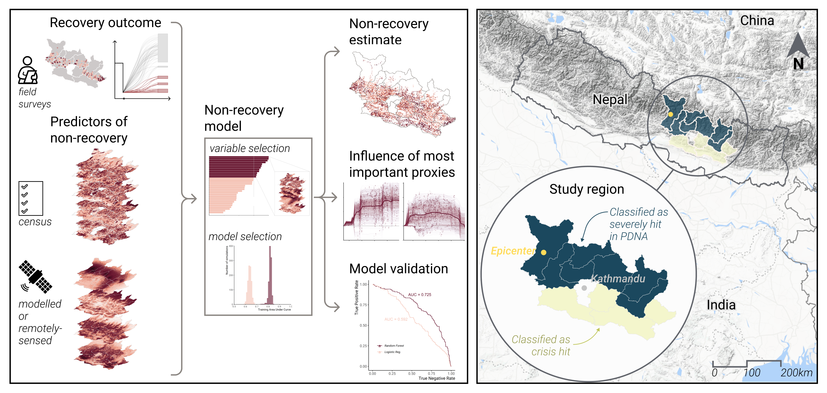
My lab takes a user-centered and data-driven approach. We aim to understand user needs and the effect of data on users’ decisions through qualitative research, such as focus groups or workshops. We then design new information systems through geospatial/GIS analysis, risk analysis, and statistical modeling techniques. We often work with earth observation, sensor, and survey data. We consider various aspects of disaster information, whether it be the hazard, its physical impacts, its social impacts, or a combination of the three.
I also focus on the communication of information, through data visualization techniques, and host a Risk and Resilience DAT/Artathon to build data visualization capacity for early career professionals.