Author: Yonas Minalu Emagnu, Schmidt Science African Faculty Fellow
How do you design a public transport system for a city growing faster than its infrastructure? In two interconnected studies using Addis Ababa, Ethiopia as a case study, Dr. Yonas Minalu Emagnu, in collaboration with Tayo Fabusuyi, has developed a scalable, data-driven framework that answers this question by integrating machine learning, geospatial analysis, graph theory, and AI-enhanced routing.
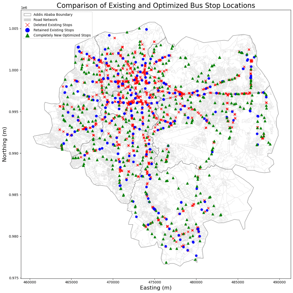
The first study addresses where to place bus stops. Using open-source geospatial data—population grids, points of interest, road networks, and cell phone tower activity—Dr. Emagnu trained a Random Forest model to predict latent transit demand and applied K-means clustering to identify optimal stop locations. The optimized network reduced bus stops by 43.6% (from 1,138 to 642) while increasing population coverage from 54% to 67%, reallocating stops from overserved central districts to underserved peripheral zones to advance both efficiency and spatial justice.
The second study addresses how to connect stops into a resilient network. Using graph theory, shortest path modeling, and Neural A* routing, Dr. Emagnu evaluated five network configurations. Global efficiency increased by 38–45%, average shortest path length decreased by 30%, route overlap was reduced by 18–25%, and connectivity improved by up to 63%—all statistically significant (p < 0.001).
Together, these frameworks provide a complete, open-data pipeline for transit planning in rapidly urbanizing cities across the Global South, demonstrating that efficiency and equity are not trade-offs but mutually achievable goals. The articles are submitted for journals and they are under review; the preprint is available on SSRN.